During the prehistoric times, the Eastern Jordanian Desert was not the desperately isolated and marginal black land that we know today. Those regions were rich in water, vegetation and animals, all what is needed for attracting human populations, not only hunters but also breeders.
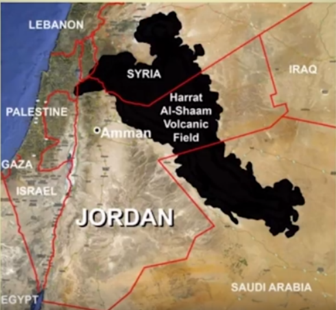
The Eastern Desert is partly covered by the lava flows descending from the volcano Jabal Druze (or Jabal Al Arab) in the Southern Syria till the plains of Saudi Arabia. This huge basalt zone is called Harret Es-Sham.
Map showing the extension of the lava flow from Jabal Druze volcano
 Gary Rollefson conf, ref. below
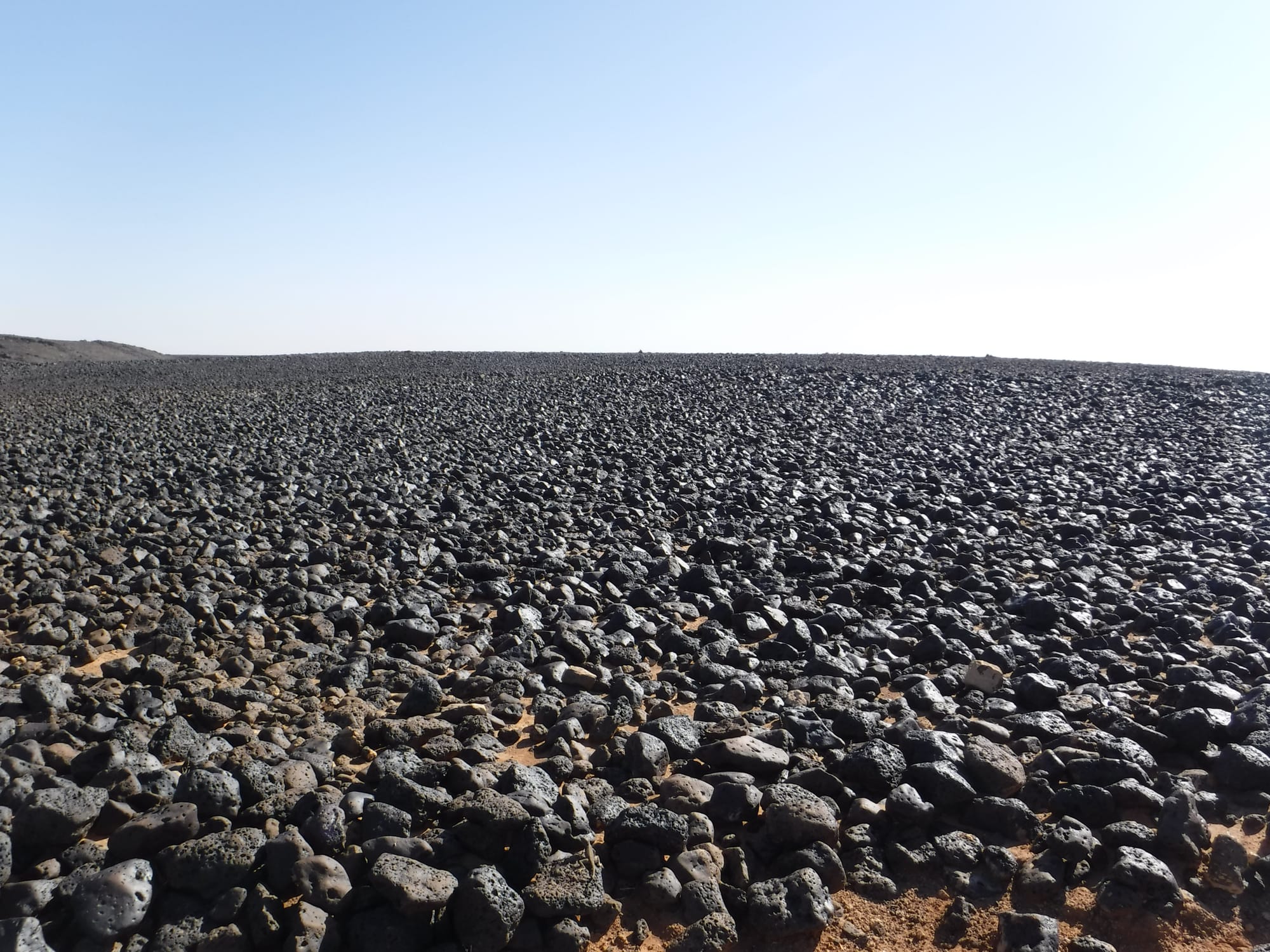
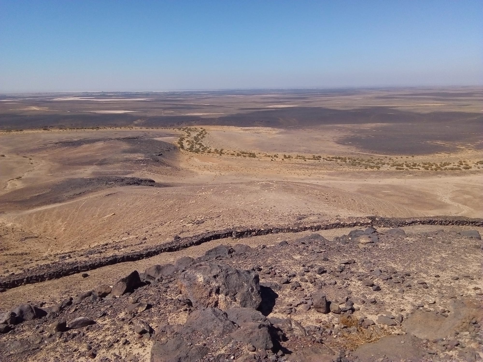
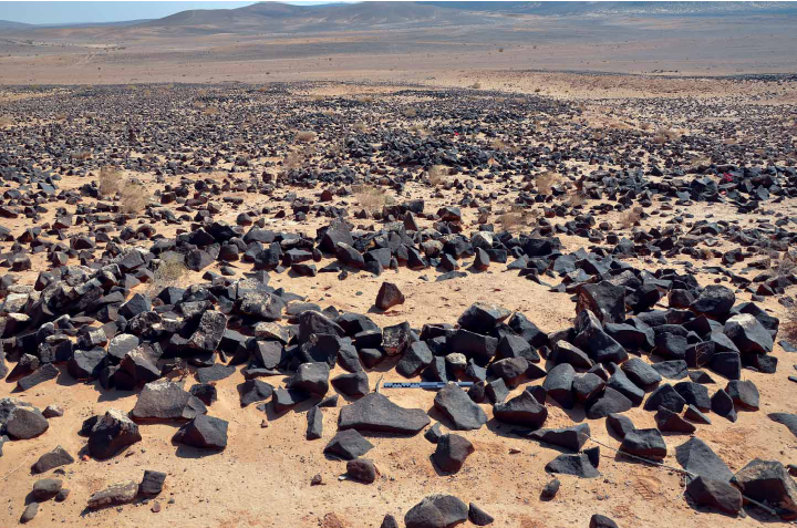
Those basalt zones are called harra and justify the name of "Black Desert" that we commonly give to the Eastern Desert, in contrast with the hamad, the sandy clear brown desert. The Harra is covered with basalt boulders of different size that make crossing extremely difficult. This is maybe the main reason why the archaeological exploration of those zones started only recently.
Harra ground
 | 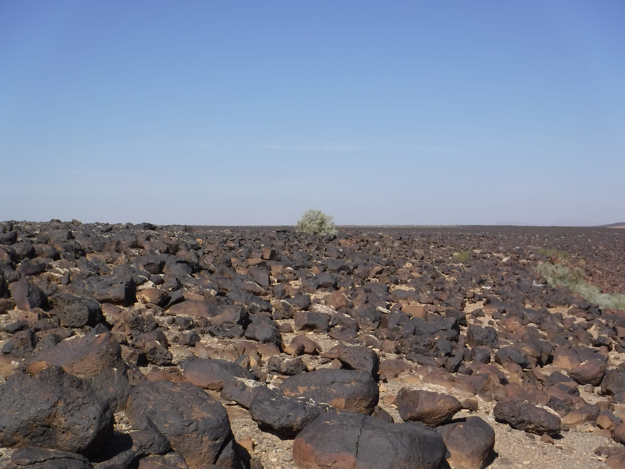 |
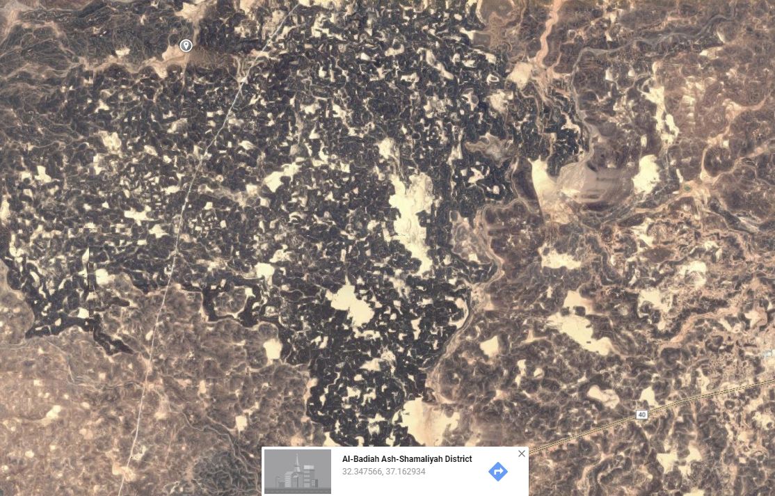
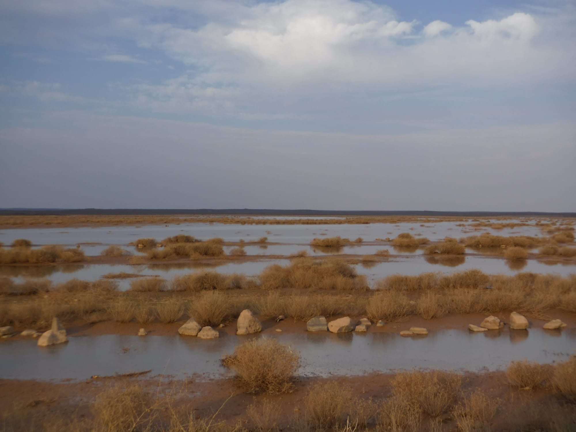
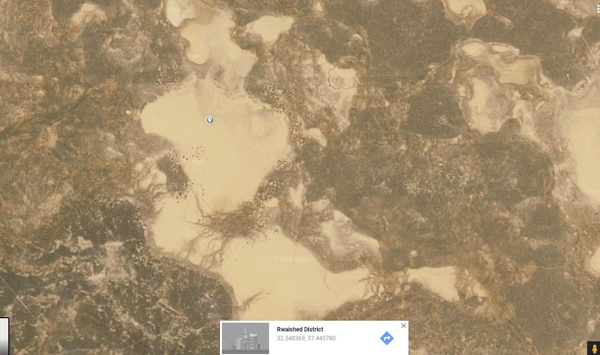
The harra is sprinkled with mudflat areas called qe'an (sg. qa'a), sediment pockets or valleys forming the hydrographic system of the harra. Those flat areas collect the rainfall during winter and are favorable to vegetation seasonal development. In the more humid Epipaleolithic and Neolithic, the mudflats were seasonal lakes and generous grasslands.
Google map capture showing the harra spotted with qe'an
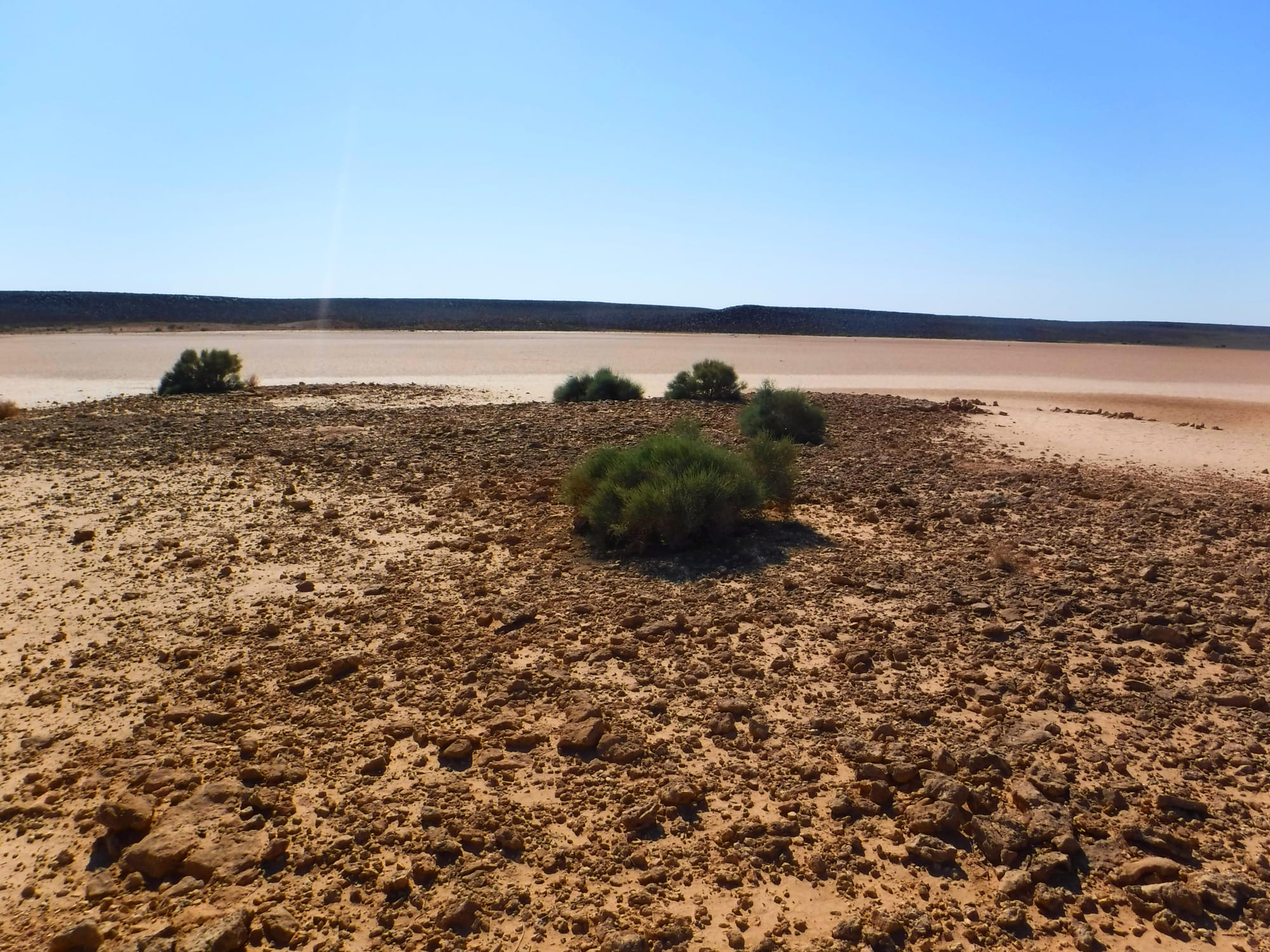
A qa'a after a winter rain | The Black Desert with brown flat mud zones |
 |  |
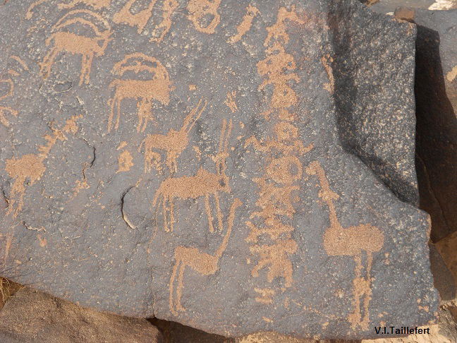
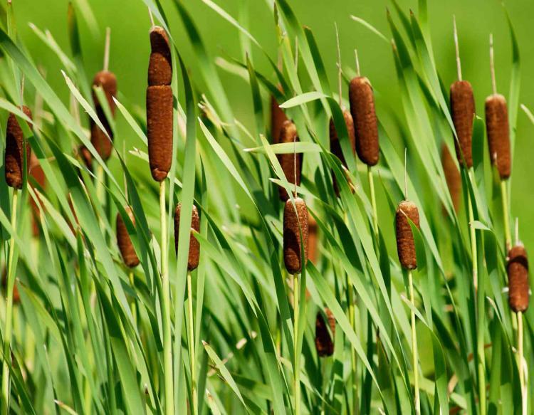
By analyzing the structure of the soils, archaeologists discovered that the lowest level were more absorbent to water: what is now a sterile area was probably be fertile. Keeping the water, the soil could be a source of humidity for a long time after the rainfalls. A soil rich in moisture created a very different landscape. A dense vegetation was hosting a lot of wild animals, as attested on the petroglyphs. Pollen analyzes and fire remains show the presence of Oaks, Pines, Juniperus, Ostrya and Ulmus, as well as of Genus Lemna (an aquatic plant) and Cattail. This last plant could represent an interesting resource beside its nutritious value, as it can be used for huts roofing, basketry and mats. What we called now the Black Desert had a totally different appearance at the Neolithic. Climatic changes occurring around 2500 - 2000 BC, together with cattle over grazing and the damages caused by the cattle hooves, have finally changed those greening areas to a hard desert.
Jabal Qurma, petroglyphs with ibexes, oryxes and ostriches | Cattail |
 |  |
Up to 7000 BC, people of the Eastern Desert lived as hunters and gatherers, following gazelles herds and moving frequently from a camp to another. An impressive shifting occurs by 6600 BC: the population of the area suddenly grows to perhaps ten to twenty times what it was a few hundred years earlier, hunting methods change and we see appearing permanent settlements in shape of huts clusters, where people spend a relative long time over the year. Beside hunting activities, we see clearly the evidence of sheep and goats husbandry. The remains of this civilization have been detected in the 20th century by the airline pilots while flying between Cairo and Baghdad. Countless structures can be observed on the satellite imagery, over the hills, along the wadies, on the periphery of the mudflats... Archaeology is currently undergoing a revolution, as not only satellite imagery but also drones allows to survey the ground at a scale and resolution with an unprecedented accuracy.
Google Earth capture with stones structures mainly concentrated around the flat mud, but also uphill
The settlements generally consist in grouped small huts and enclosures. The huts are mainly rounded, but we can find also some roughly squared. The dwellers raise cattle and, in many cases, animal pens are contiguous to the huts. It will need years to survey the huge domain of this civilization extending between 7000 and 5000 BC, the researches are still at their beginning. Area of Jabal Qurma (photos below) is investigated since some years.
round structure at the proximity of Jabal Qurma | circular walled structure on the top plateau of Jabal Qurma | Jabal Qurma arial view |
 Peter Akkermans, Merel Brüning art. ref. below | 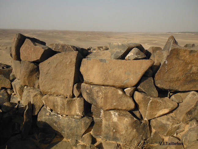 | 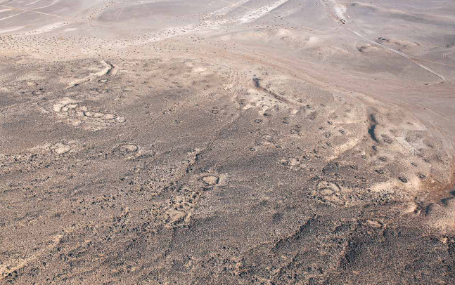 Peter Akkermans, Merel Brüning art. ref. below |
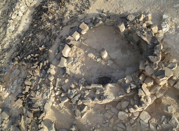
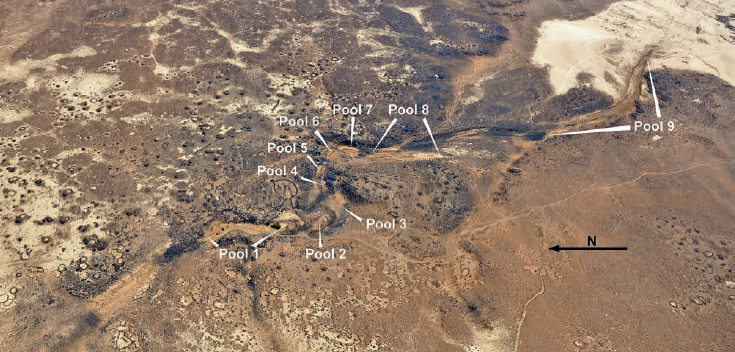
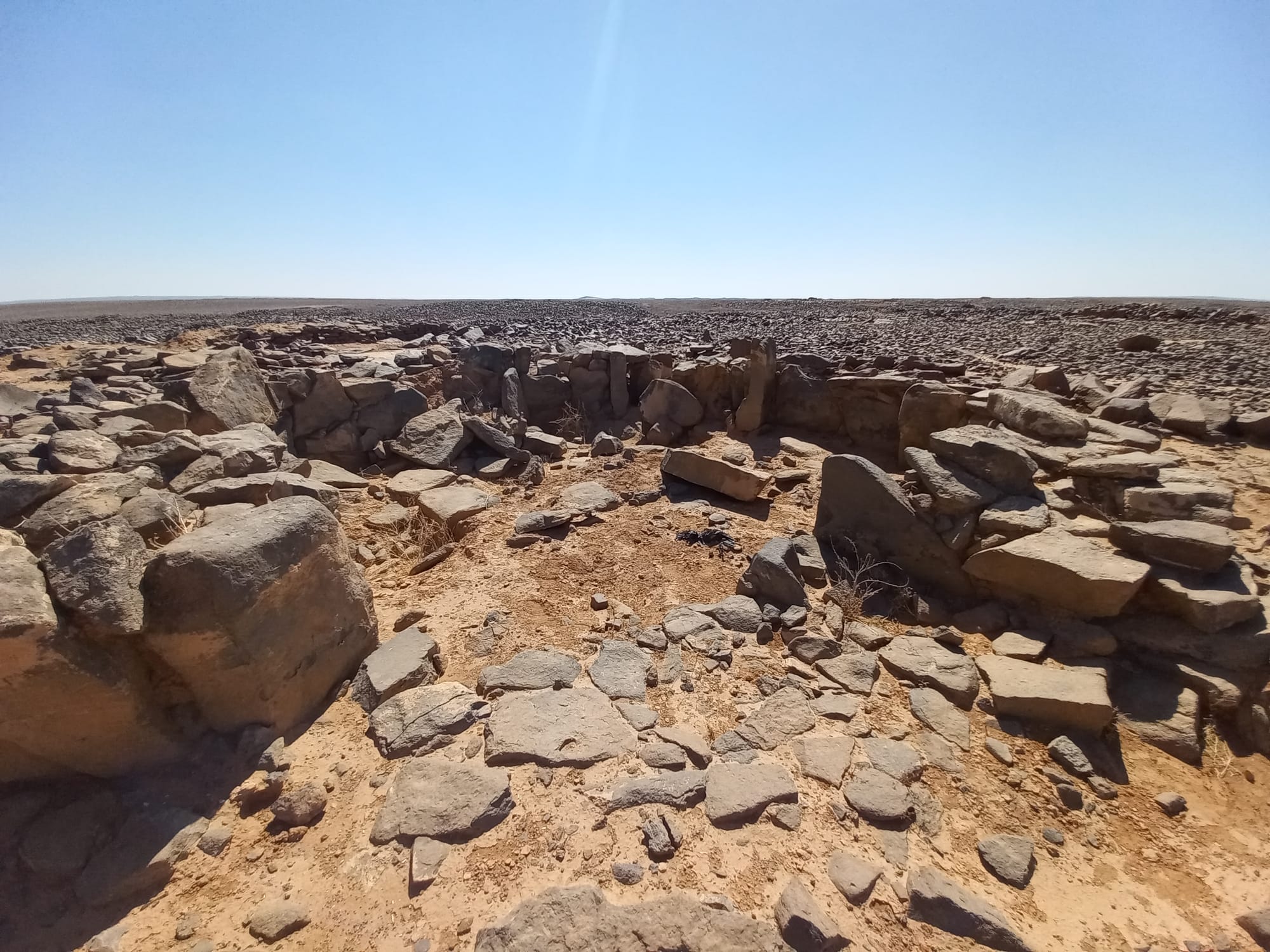
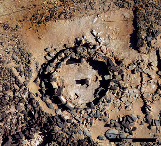
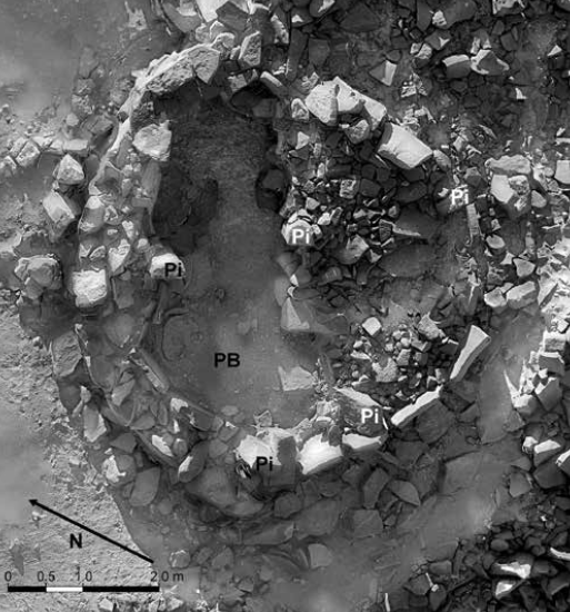
Further to South-East, at the eastern edge of the harra, the area of Wisad Pools caught the scholars' attention due to an extraordinary density of settlements. Wisad Pools is an immense site covering about 10 km2. The place is so called due to numerous water cisterns that dwellers dug for their supply and that are still used by Bedouin nowadays. Archaeologists have identified 400 - 500 structures (excluding animals pens), among which different types of tombs, structures of unknown functions and between 200 to 300 residential houses.
Those houses are permanent but their occupation is seasonal, from some weeks to some months over the year and possibly reused on regular basis. All the dwelling are not occupied all together or all in the same time, but the surveys could identify simultaneous occupations by clustered families. Those people raise cattle and, in many cases, animals' pens are contiguous to the huts. | 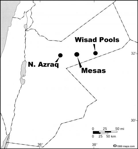 | |
 Gary Rollefson (3) art., ref. below Gary Rollefson (3) art., ref. below |
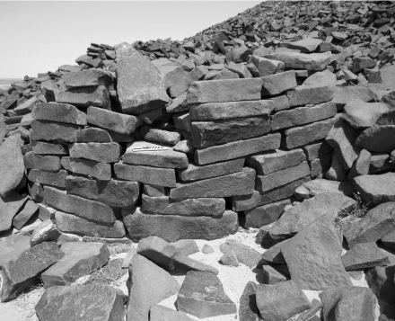
 Yorke M. Rowan, Gary Rollefson, Alexander Wasse, Austin “Chad” Hill, Morag M. Kersel art, ref. below Yorke M. Rowan, Gary Rollefson, Alexander Wasse, Austin “Chad” Hill, Morag M. Kersel art, ref. below | Some buildings present a good preservation condition. They were maintained with care through several rebuilding process, as show the following examples of W-66 and W-80:
W-66 house is dated to Late Neolithic (6606 - 6455 BC). Its interior diameter is 4.25m. In the center of the room, a pillar is still standing, the function of which may be to support the roofing. On the ground, we still see traces of plaster. Some parts of the house reveal four levels of replastering. A cache with eleven pestles have been found in this house. | |
This other house, W-80, was rebuilt several times and had a more complex structure. Tow external areas served as working areas. Very large slabs fixed with mortar constitute the floor. The dating gives a period between 6590 and 5610 BC. Archaeologists found in this house a rich lithic material, among which a large collection of flint points | 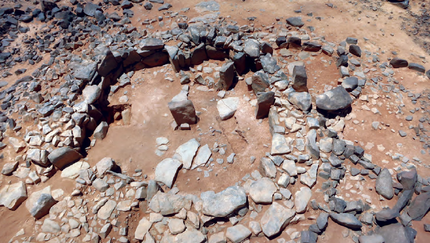 Yorke M. Rowan, Gary Rollefson, Alexander Wasse, Austin “Chad” Hill, Morag M. Kersel art, ref. below |
The dwellers were shepherds, but also hunters. Among the bones remains that we found in their habitats, only 10% come from domesticated goats or sheep. The 90% come from gazelles. Hunting practices allowed them to preserve the cattle resource, that should have been use for something else than meat supply.
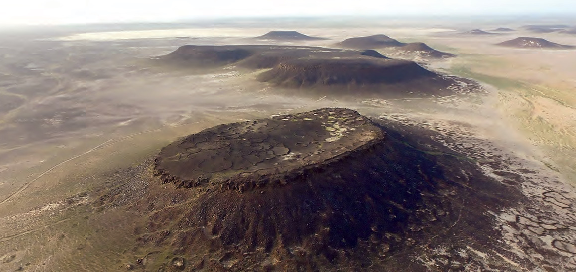
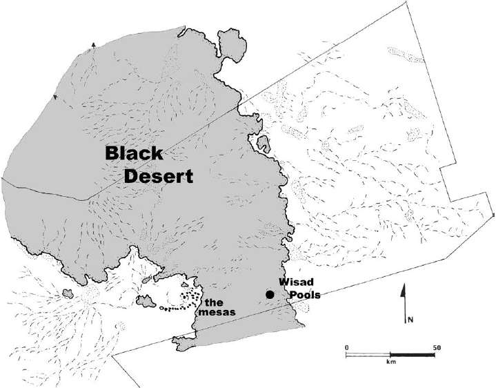 Gary Rollefson (3) art., ref. below Gary Rollefson (3) art., ref. below | About 60 km to the West, on the western side of the Harra zone, a chain of more than 50 mesas stretch out along a large plain gathering different wadies, among them Wadi al-Qattafi, Qara Qataf, and Wadi Umm Nukhayla. Those basalt formations seem to raise up 40-60 m over the plain, but they effectively result from the erosion of the underlying limestone levels. Archaeologists started very recently surveying the mesa of Wadi Qattafi (in the red circle opposite). | 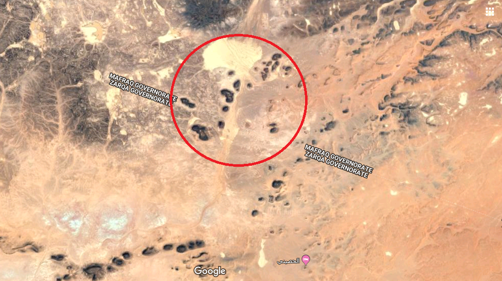 |
 Austin “Chad” Hill, Yorke Rowan art., ref. below
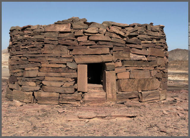
Generally, the flat tops of the mesas are free from clustered settlements, but contains surface lithic deposits dating to the PPNB and PPNC or earlier periods, as well as tombs of Chalcolithic and Early Bronze Age that were, for some of them, subject to a reuse during the Safaitic period (2nd to 4th AD). The tops contain also enclosures that look like animals' pens, with some little huts that maybe served of shelters for the shepherds. The slopes of the mesas are covered with hundreds of clustered domestic buildings (photo below) with a surprising density, mostly circular, between 2 to 10 m in diameter, built with large slabs. The height of the huts wall can reach till 3 m. The builders took advantage of a local particularity of the basalt that fractures in rectangular slabs for erecting the walls. In the early step of the surveys, those collapsed structures appears to be funerary buildings similar to the nawamis (Ar. sg. namus), a kind of circular tombs known in the Sinai. However, the nawamis are not attested before the 4th millennium BC and the first structures excavated around the mesas refer clearly to the Late Neolithic (7th and 6th millennia BC). If it would need years to have a clear idea about the dating and the function of the different structures that we found on the slopes of the mesas, it is striking to observe that the area of mesas and Wisad Pools attest of a particularly intense occupation between 6900 and 5000 BC.
 Gary Rollefson (2) art., ref. below Gary Rollefson (2) art., ref. below | 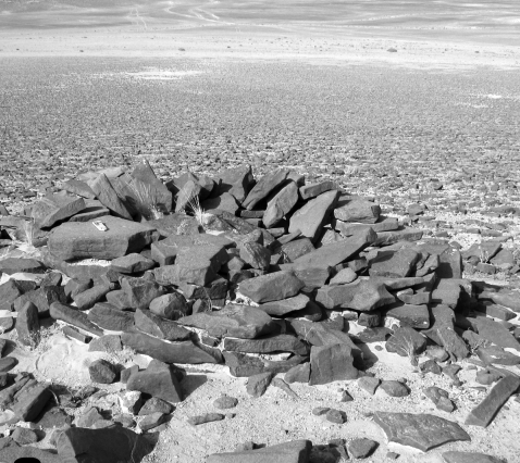 Gary Rollefson (2) art., ref. below Gary Rollefson (2) art., ref. below |
 Gary Rollefson (4) art., ref. below Gary Rollefson (4) art., ref. below | 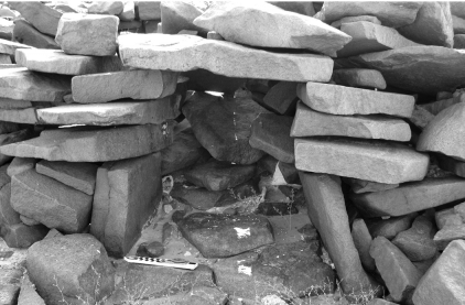 Gary Rollefson (2) art., ref. below Gary Rollefson (2) art., ref. below |
Namus tomb in the Sinai. Their structure could eventually be similar to the huts found at the Wisad Pool and Wadi Qattafi
References:
Gary Rollefson (1): https://www.acorjordan.org/2017/11/16/people-neolithic-black-desert-acor-video-lecture/
Gary Rollefson (2): https://journals.openedition.org/syria/1803
Gary Rollefson (3): https://www.researchgate.net/publication/314179811_Greener_Pastures_7th_and_6th_Millennia_Pastoral_Potentials_in_Jordan's_Eastern_Badia/download
Gary Rollefson (4): https://www.researchgate.net/publication/312592829_Investigations_of_a_Late_Neolithic_Structure_at_Mesa_7_Wadi_al-Qattafi_Black_Desert_2015
Stefan L. Smith, Marie-Laure Chambrade: https://www.mdpi.com/2076-3263/8/12/491/htm
G. Rollefson, Y. Rowan, A. Wasse, M. Kersel, A.C. Hill, B. Lorentzen, J. Ramsay and M. Jones: https://www.academia.edu/37679394/Excavations_of_Structure_W-80_A_Complex_Late_Neolithic_Building_at_Wisad_Pools_Black_Desert_Jordan_
Peter Akkermans, Merel Brüning :www.researchgate.net/publication/272254161_A_landscape_of_preservation_Late_prehistoric_settlement_and_sequence_in_the_Jebel_Qurma_region_north-eastern_Jordan
Peter Akkermans (ed.): Landscapes Of Survival, The Archaeology and Epigraphy of Jordan's North-Eastern Desert and Beyond, SidestonePress 2020. https://www.academia.edu/44762065/LANDSCAPES_OF_SURVIVAL_The_Archaeology_and_Epigraphy_of_Jordans_North_Eastern_Desert_and_Beyond?fbclid=IwAR3x_zFOktxESMLOMGe8Pj8i_KEdySnD42cWZMTNcF2XB8v734JxgAbv2f8
Yorke M. Rowan, Gary Rollefson, Alexander Wasse, Austin “Chad” Hill, Morag M. Kersel: https://www.academia.edu/33701574/The_Late_Neolithic_Presence_in_the_Black_Desert
Austin “Chad” Hill, Yorke Rowan: https://www.researchgate.net/publication/317554865_Droning_on_in_the_Badia_UAVs_and_Site_Documentation_at_Wadi_al-Qattafi
Lecture:
Was Jordan's Black Desert green during the Late Neolithic? https://www.youtube.com/watch?v=Zg2zHK3GfiQ